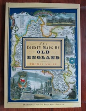
The County Maps of Old England

Moule, Thomas
Publication Date 1992
ISBN 1851704035
Publisher Studio Editions,
Binding Hardback
Condition Near fine, bright copy in very good dust jacket
SKU 25136
Notes Book is very clean bright and neat. Hint of dustiness to the dust jacket.

Description

Hardback. Reprint. Large colour maps of each of the 39 English counties including Lancashire, Yorkshire, Rutland, County Durham, Northumberland, Devon, Cornwall, Cumebrland, Westmorland etc,. plus maps of London, Oxford, Cambridge, Bath and Bristol, Plymouth, Boston, Isle of Man, Isle of Thanet, Isle of Wight, Monmouthshire etc. Introduced by Roderick Barron. Large format: 360 by 260mm (14¼ by 10¼ inches).
Price: £12.00
You may also be interested in books cross-referenced in the following areas:
Other books in this category
By clicking "Accept All" you agree to the use of analytical cookies that we use on our website to measure usage. These cookies provide information that will help us to improve our site and enhance user experience. By clicking "Manage Preferences", you can manage your consent and find out more about the cookies we use.
Manage your privacy preferences

These are functional cookies needed to keep our website working properly and give you the best experience when visiting our website.

We collect information about how visitors use our website. The information is in aggregate form and counts visitor numbers and other information to help us improve our website.

These cookies ensure that, if applicable, any adverts are properly displayed and targeted based on your browsing. They may also be used to integrate social media on our site.

We may use assets from 3rd parties on our website, for example, Google fonts, which enhance your viewing and visual experience.

Read our privacy policy