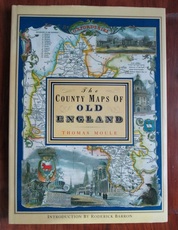
The County Maps of Old England
Moule, Thomas
| Publication Date |
1992 |
| ISBN |
1851704035 |
| Publisher |
Studio Editions, |
| Binding |
Hardback |
| Condition |
Near fine, bright copy in very good dust jacket |
| SKU |
25136 |
| Notes |
Book is very clean bright and neat. Hint of dustiness to the dust jacket. |
Description
Hardback. Reprint. Large colour maps of each of the 39 English counties including Lancashire, Yorkshire, Rutland, County Durham, Northumberland, Devon, Cornwall, Cumebrland, Westmorland etc,. plus maps of London, Oxford, Cambridge, Bath and Bristol, Plymouth, Boston, Isle of Man, Isle of Thanet, Isle of Wight, Monmouthshire etc. Introduced by Roderick Barron. Large format: 360 by 260mm (14¼ by 10¼ inches).
You may also be interested in books cross-referenced in the following areas:


